Is this the South Islands most epic hut? Brewster Hut, Wanaka
Brewster Hut, Wanaka, South Island
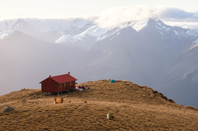
Brewster Hut had been on my bucket list for so long and I have to say, it totally lived up the hype. If you’re looking for epic sunrise and sunsets, views of the mountains and glacier views, you’re in the right place, so let’s spill the tea.
Do note that before you get excited and just rush in to book, this is an alpine hike, not for beginner trampers and is weather dependent, so have a read, keep safe and lets get cracking!
Brewster Hut Track in a Nutshell
- 2.5 km one way
- DOC recommends -4 hours one way and we took 4 hours, 20 minutes with a decent lunch break and morning tea and with three kids in tow.
- Brewster Hut was 12 beds and these can be booked online in advance
- Difficulty: Hard yakka
Where is Brewster Hut?
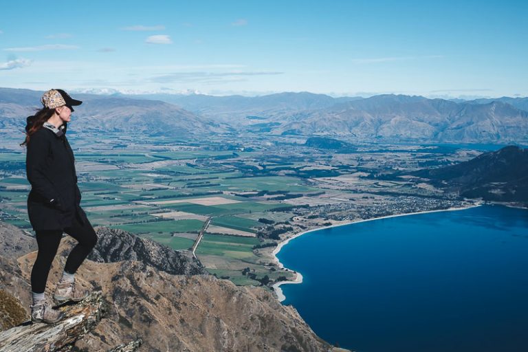
You’ll find Brewster Hut in the Makorora region, about an hour from Wanaka in New Zealand’s South Island. It is a popular hut in Mt Aspiring Hut. Wanaka is the closest township and can be a good place to stock up on supplies and get accommodation for the night before.
How to get to Brewster Hut Track?
To get to the Brewster Hut Track, you’ll need to drive about an hour from Wanaka towards the West Coast until you reach the Fantail Falls carpark. This is a popular South Island Road Trip stop and you’ll find the start of the Brewster Track here.
Where is the Brewster Hut Track start?
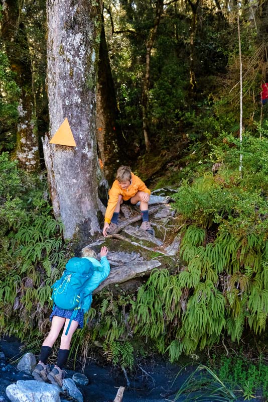
If you can’t find the start of the Brewster Hut Track once you’re at the Haast River, here’s a little hint. You will see Fantail Falls to your right, then scan on the far side of the river, all the way to the left and you will see an orange marker up in the trees. This is the start of the track and you’ll need to cross the river to get there
Caution:Crossing the River at the Brewster Track
This is probably the downfall of the whole track as your whole tramping party will need to cross the Haast River to start. Note this is an alpine river and it will be freezing cold all year around. After decent rainfall it can be unsafe to cross, so you really need to assess the river before you start your tramp.
Please make sure you know how to cross a river safely before attempting to do this. I travelled with 3 kids (5,8,10) and the river was just below their knees, but they did freak out in the cold water. It is probably safer to tramp through the water with their boots on, then to take them off in the freezing water. Another alternative is to have a spare set of shoes.
Do note that you will need to cross the river on the way out too. So again if there is any rain, this may stop you from actually crossing the river and its a 3 hour climb back up to the hut for shelter.
For this reason, you may need to carry extra gear to wait out the river or be very clever about the weather you attempt this hike in.
You can find resources about safely crossing rivers at the NZ Mountain Safety Website and I also would recommend calling the Wanaka DOC site for any local weather forecast information.
How hard is the Brewster Track?
The track to Brewster Hut is tough. You have about 950m of elevation gain over 2.5km and if you’re not sure what that means… its very steep and practically straight up.
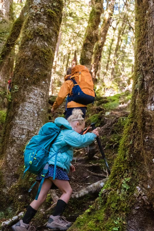
Trampers will need to be able to navigate using marker poles and tree markings and at times, will need to pull themselves up on tree roots to ascend to the top.
While the track does end at Brewster Hut, some experienced climbers hike up to Brewster Glacier. This requires advanced skills and mountaineering experience for not only saddling the ridges to get here, but hiking over snow and ice in fragile glacier conditions.
Brewster Hut Track is not a beginner hike.
How long is the Brewster Hut Track?
DOC recommends this hike to take 3-4 hours to ascend. With my three children, including my 5 year old, this took us 4 hours and 20 minutes including a lunch break and morning tea stop.
What is the Brewster Hut Track like? The details
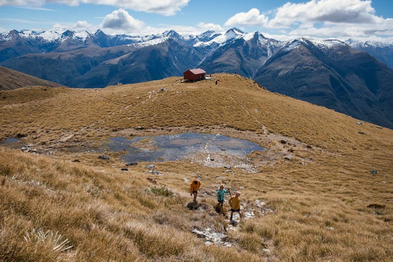
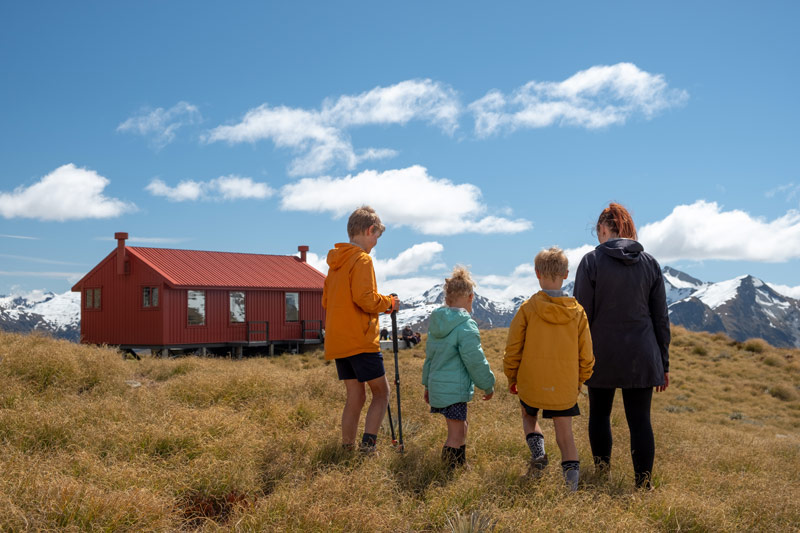
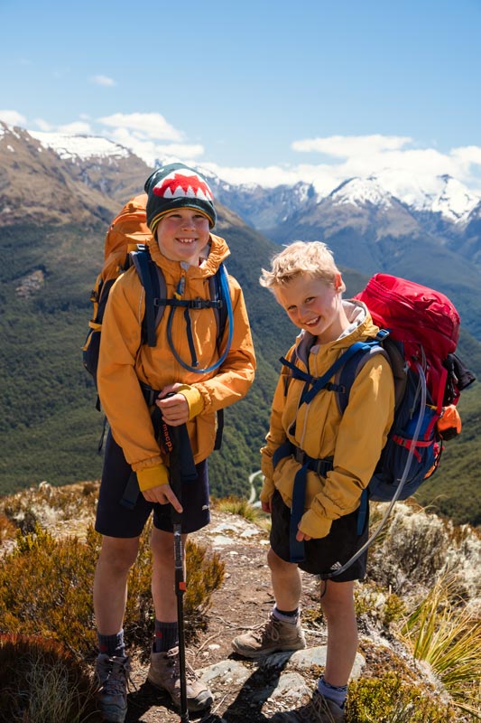
I completed this walk with my 5,8 and 10 year olds who are experienced trampers. They carry their own gear, are good underfoot and have hiked many long distance trails up to 18km in a day. I’ll note again that this isn’t a beginners track and it is very tough.
Despite a 0 degree morning, we had great sunny weather, we had contacted DOC visitor centre about the snow conditions at the hut, to which they said there hadn’t been any recently and we should be able to reach the hut with no problems.
The river crossing was a bit of a fail and I decided we should just take our boots off and walk across, so we didn’t have wet feet for the whole tramp. Well, the water was so freezing, the kids freaked out and that wasn’t exactly a good start. But, it was only a few minutes, they didn’t die and recovered quickly (on the way out we just walked in our boots and our feet didn’t even get cold)
Find a patch across the river that isn’t too deep. We could see the marker ahead of us on a tree, but headed a bit to the right first to get a good angle. Please make sure you know how to cross a river safely as a group before attempting and do not attempt if the river is too deep. If you have hiking poles, I’d definitely recommend them, for the river crossing and the descent.
You’ll then see the big beech forest ahead of you and bar the first 100 steps, that is the last you will see on flat ground.
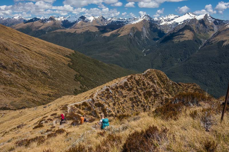
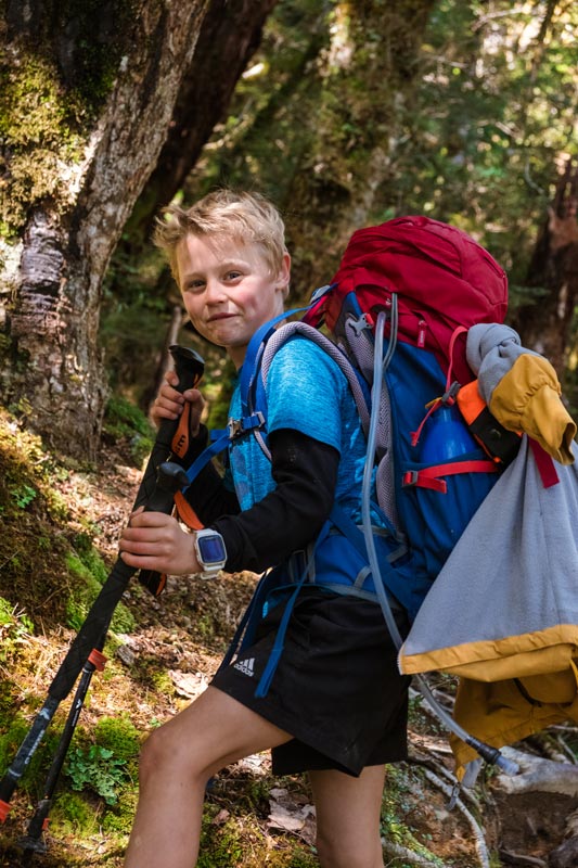
The word of the day is relentless. The track climbs steadily all the way to the top of the bushline. You’ll hold onto tree roots to pull yourself up and you’ll get some good butt muscles I tell you. A pack with overnight gear will make this harder but I wouldn’t trade the views for a day climb, definitely worth staying overnight.
We took a morning tea break after an hour and lots of little pauses along the way. It really is just one foot in front of the other and while the photos look peaceful and idyllic even, it was hard work and all we wanted to do was get out of the bush.
For our family, it took us about 3 hours and 15 minutes to get out of the bush, then we had about 30 minutes for lunch, and then there was another 40 minutes or so to the hut.
Once you get out of the bush, there’s another steep climb or so, and then you are finally at the ridgeline section. This ridgeline is my favourite part of the hike and while it’s still uphill, the views and hope keep you going. You’ll spot the DOC red toilet first and then you know you are close. It’s amazing how much more energy you get when you know you are almost there
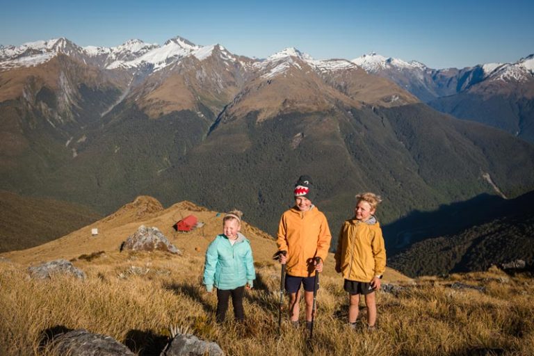
The hill are alive!! You have made it to Brewster Hut. After that slog, you need a pat on the back.
Brewster Hut: The details
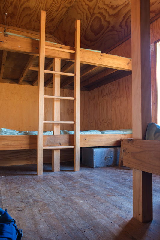
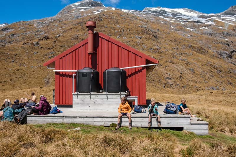
Brewster Hut is a cute 12 bed hut sitting on a flat plain, way above the Haast River in our beautiful New Zealand mountains.
Inside Brewster Hut you will find
- 12 bunk beds, platform style, with mattresses
- Water, although its noted on the DOC website there might not be sufficient water in summer
- Kitchen area, no gas provided
- No heating or fire
- Long drop toilet outside the hut
A great feature is the big deck out the front and even on a cool sunny day in Spring, it was warm and inviting. All hut goers chose to eat outside and bask in the sun, make their food and chill until the sun went down.
If you climb up the hill a wee bit, just behind the hut, you’ll be in a good spot for sunset views. Unfortunately it was a little cloudy to get any real colour, but not a bad spot to sit in nonetheless.
How to book Brewster Hut
Brewster Hut must be booked online before you visit between Labour Weekend (late October) and 30 April. As it only has 12 bunk beds and is a popular hut, I’d make sure you get your dates if you aren’t flexible.
Book online at the DOC website.
Hiking to Brewster Glacier
It’s worth noting that a number of people have needed to be rescued on the hike to Brewster Glacier. There is no marked track and the DOC website says you must have mountaineering experience and advanced tramping skills to complete this hike. So please heed the warnings here.
A good hike, assuming its not icy up there, is to the top of the hill where you get a good view of the glacier (photo below) and over the hut below. If you’re looking at the hill, you’re heading straight up and to the left.
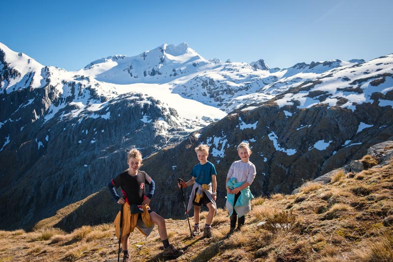
The point beyond here, the trail is on the edge of a rock face. It’s quite narrow and a lack of balance would see one careering down the cliff face. It can be quite difficult to navigate although there are a few cairns on the way. We found it harder on the way back, than the way there.
We actually didn’t make it all the way to Brewster Glacier. We watched as some fit able people clung to the cliff face, over the icy footsteps in the snow and decided to avoid this. We made a smart choice because a cool view isn’t worth the risk. One day we will come back further into the summer when perhaps it’s not snowy and icy.
I wouldn’t recommend this side for kids unless you really know what you’re doing.
Other awesome hikes you might love
- Wanaka: Rocky Mountain Track (3 hours return)
- Wanaka: Rob Roy Glacier Track (3-4 hours return)
- Wanaka: Roys Peak, the iconic Lake and mountain views (6-8 hours return)
- Wanaka: Isthmus Peak (6-8 hours return)
- Wanaka: Aspiring Hut: 2-3 hours one way, an easy family friendly hike
- Wanaka: French Ridge Hut, an advanced 17-18km hike one way to epic mountain views
- Wanaka: Breast Hill Track (off the beaten track advanced hike 6-8 hours return)
- Queenstown: 5 Awesome Queenstown Walks

Jennifer
Founder of Backyard Travel Family
Jen is a super organiser when it comes to travel. Having travelled extensively in Europe and Africa, has lived in London and the USA and holidayed in many parts of Asia, she is not a newbie to the travel space
Jen has three young children, 10 and under and travels around New Zealand with them.
what you need to know
Travel
- The start of the Brewster Track is about an hour from Wanaka
- Head from Wanaka to towards the West Coast on the Haast Makarora Rd and put in "fantail falls" into google maps. This will take you to the carpark
The track
- steep uphill track
- Allow 3-5 hours uphill with stops
- about 1000m in elevation gain over just 2.5km so this is steep
Suitable for kids?
- not suitable for beginners
- kids should be able to walk up steep hills with overnight packs
- navigation is required through the bush between poles, however it is not too difficult to find
- Plenty of preparation on steep uphill tracks prior to this would be required
Facilities
- toilet in the carpark and at the hut
- river crossing required
- track is sheltered in the bush but very exposed on the ridgeline
What to bring
- this is a full day walk, or an overnight trip so make sure you bring appropriate clothing and gear
- see our tramping packing list (click here) for everything you will need. It is an alpine walk so you need good thermals and strong boots no matter the season
Food options
- Makarora Store (15 minutes ish down the road) has a cafe for a good post hike meal or an ice cream otherwise Wanaka is your main centre for supermarkets and supplies

