Mt Somers Track: A Guide to all the Mt Somers hikes and walks

Mt Somers Track: A Guide to all the Mt Somers hikes and walks

Mt Somers Track

The Mt Somers Track in the Mid Canterbury region offers a myriad of hiking options from bush trails to high country plains, mountains and views galore.  It really does have something for everyone.  From the Mt Somers summit for advanced hikers to the family friendly Woolshed Creek Hut hike, the Ashburton region is a great place to hike.

This Mt Somers New Zealand Guide will cover everything you need to know from family friendly huts and trails, to the full 17.1km journey from one side to the other as well as the Mt Somers Summit route.  

One thing I find very inconsistent is the timings and distances for the Mt Somers hike.  The DOC website is often different to Mt Somers track map and even the signposts differ.  So in each section, I’ll let you know the “official timings” and also how long it took us so it might give you a good gauge when planning your tramping trip.


Mt Somers Hike durations and options

From Pinnacles Hut / Sharplin Falls Carpark

From Woolshed Creek carpark

Click above to link to your preferred walk or scroll down to view them all

kids smile after climbing the hill behind Pinnacles Hut on the Mt Somers track
Up above Pinnacles Hut on the Mt Somers Track towards Woolshed Creek Hut

Sharplin Falls Walk (40 minutes)

If you had walked the Sharplin Falls track pre-2023, you’ll notice that its a little different now and the trail is a little longer.  The Sharplin Falls track is now a completely new trail up to the waterfall and the community who slaved away has done such a good job.

This short walk in Mt Somers is a little undulating with some short climbs but overall is not a difficult walk.  There’s a great big bridge, a platform to see the lovely little waterfall and an access point to the stream where you can rock hop and play.

The waterfall isn’t a huge must see, however its a lovely short walk through the bush and is ideal for the whole family.

It will take approximately 40 minutes to reach Sharplin Falls and if you are visiting the nearby Staveley Ice Rink, its a great additional activity

Read more:  Sharplin Falls walk on the Mt Somers walkway (more photos and details here)

Wide angle of sharplin falls nested in between the trees. its a small to moderate size waterfall filled with rocks
The Sharplin Falls is a great Ashburton walk taking around 40 minutes to reach the viewing platform of this pretty little waterfall

Hiking to Woolshed Creek Hut (2-3 hours)


Tramping to Woolshed Creek Hut is likely the most popular walk on the Mt Somers Track.  It’s touted as a great family friendly tramping experience and is a great beginners hike.

Starting at the Woolshed Creek carpark on Jig Road, just past Mt Somers village, you’ll want to follow the signs for the Miners Track.  (The bus stop / Rhyolite track is a more advanced climb in terms of navigation and physical exertion.  Its a toughy)

It starts relatively flat then heads up the hill to the old coal mine.  This climb takes around 20 minutes from memory and is the hardest part of this climb.  So if you find this a little tough, don’t fear, it flattens off after that.

After you’ve check out the mine, its a flattish trail through the forest and you’ll come to a fenceline where you can make a decision.  The original miners track heads up the hill in front of you and down into Woolshed Creek.  This is a little harder.  Or else you can turn left and follow the fenceline to the 4WD trail which is gentler and you don’t have to worry about your footing.

Either way, it’s one more incline then a steep downhill into Woolshed Creek Hut

DOC says the trail will take 3 hours, but it usually takes us about 2 hours 15 minutes.  3 hours would be the absolute maximum with stops

Read more:  I have a full article on hiking Woolshed Creek here

Beautiful mountain views hiking to Woolshed Creek Hut

Hiking to Woolshed Creek Hut via the Bus Stop Track (3-4 hours)

This is a much tougher climb but if you’re a good hiker or have done the miners track before, this is a good challenge.  It also means you can hike to Woolshed Creek Hut and make it a loop track which is far more interesting.

We’ve only completed this trail in the opposite direction (from the hut to the carpark) and from the hut information it said it would take 4 hours and I think with my 4 year old, this took closer to 5 hours.  (but he was 4 years old so understandably took longer)

You’ll start this trail at Woolshed Creek carpark and head over the bridge (not the Miners track) and head straight up the hill.  When its dry it can be quite slippery as there are lots of rocks and slippery scree especially near the top.  I remember it being a little dodgy coming down this section.

After you’ve had this steep climb you’ll shortly see a signpost, left towards the Bus Stop and Woolshed Creek and right towards the South Face.  Head left and you’ll find some board walks, the bus stop which is a cool overhang for a wee photo and the ironic bus stop sign then you’ll head down into the bushy section.

You’ll head up and down the hills in the bushy section which can feel a little demoralising going up again, only to head down.  There’s a wee waterfall side trip and when you hit the one person bridge, you’ll only a 5 minute or so walk to the hut!

DOC also says this track takes 3 hours, however its a very different 3 hours than the Miners Trail.  I’m confused as to why these have the same timings as this Bus Stop track is certainly much longer.  I’d allow about 4 hours for doing this for the first time.

Here it is! The modern Woolshed Creek Hut, one of the overnight huts on the Mt Somers Track, Mid Canterbury, New Zealand
Woolshed Creek Hut is a serviced hut with wood provided in the woodshed

1-3 days on the Mt Somers Track – one way hike


A great first multi day hike on the Mount Somers Track, visiting Pinnacles Hut and Woolshed Creek Hut.

In this section I will break down the whole walk so you an figure out if this is the right hike for you.

  • Total hike length: 17.1km
  • Pinnacles carpark to Pinnacles Hut: About 3 hours
  • Pinnacles Hut to Woolshed Creek Hut: 2-3 hours
  • Woolshed Creek Hut to Woolshed Creek Carpark: 1 hour, 45 minutes

If you are looking for a good introductory multi day tramp for families or beginner hikes then the Mt Somers Track is a good place to start.  The track isn’t too difficult compared to many multi day hikes and the short distances between each hut means this is a very light 3 day 2 night experience, or just have one longer day and stay at one hut on the way.

Woolshed Creek Hut is the most popular hut on the Mt Somers Track so it does book up quite quickly on weekends and school holidays but it’s totally doable to skip this hut on the way in or out.

Transport on the Mt Somers walk is the hardest part as you’ll need a vehicle at both ends of the track, or you can do the full loop that comes back along the South Face.  This is the only section of the Mt Somers Track that we haven’t done and would make for a very long last day.


Day Hike on the Mt Somers Track: Mt Somers Track Review 

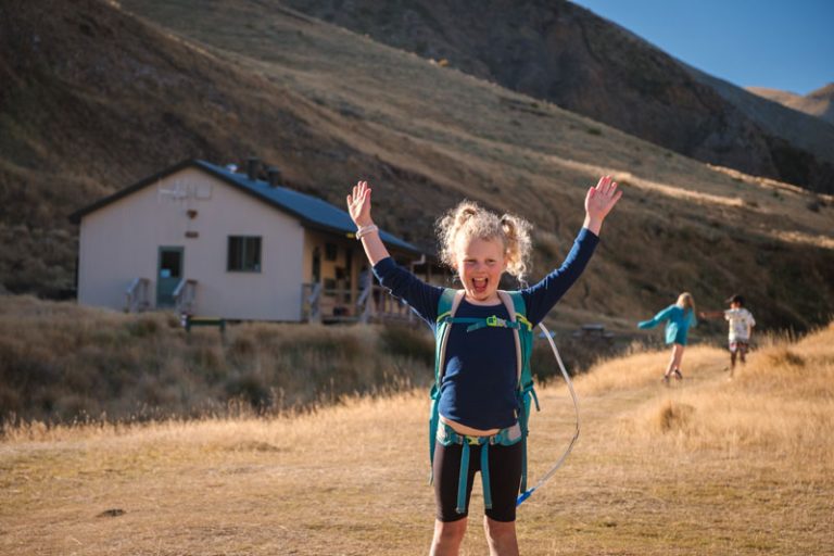
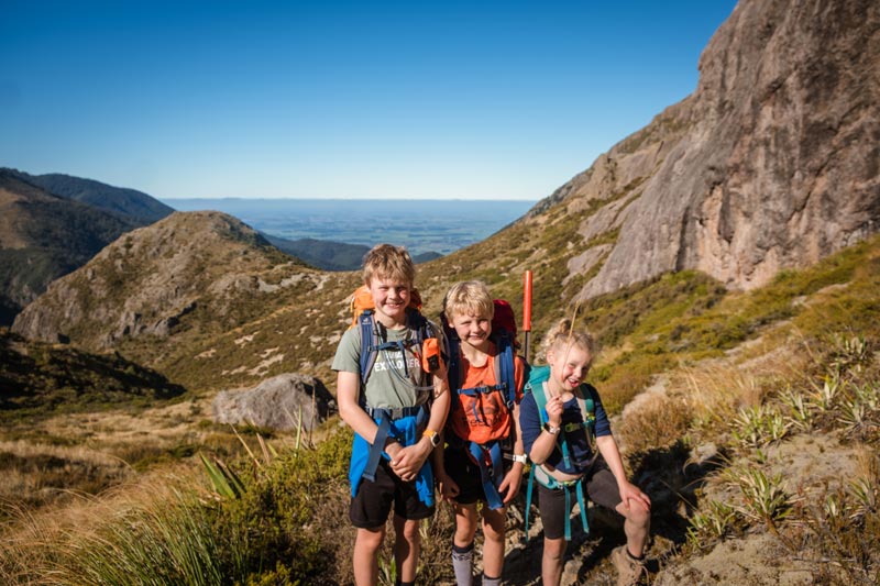
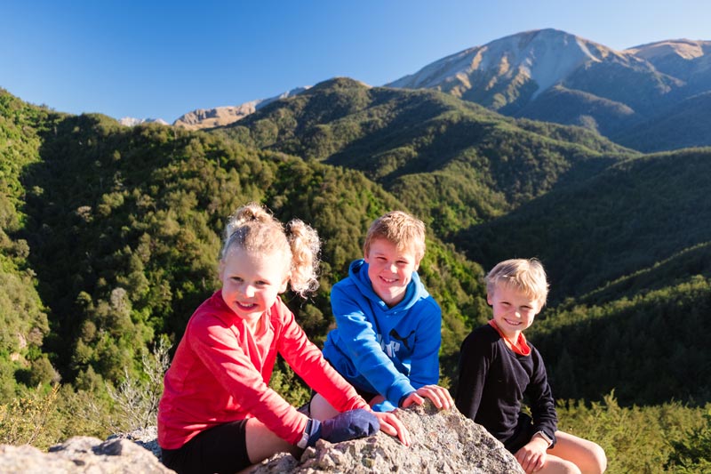
We are local to the region and took on the Mount Somers Track with our almost 6 year old, 8 and 10 year old.  We decided to do this as a day hike due to time restraints and to make our gear carry a bit lighter.

We dropped one vehicle at the Woolshed Creek car park then headed back to the Sharplin Falls carpark (Pinnacles car park) to start our hike.  We chose to hike in this direction as the walk into Pinnacles Hut is the hardest section and quite undulating so I wanted to do this while we had the energy and concentration.  I also knew that it was likely we would walk out in the dark and the Woolshed Creek miners trail is far less technical so an easier walk with head torches.  The walk is majoritively downhill, making for an easier finish, compared to Pinnacles which is more undulating so still requires more physical effort.  Still happy with this decision and would recommend it this way.

  • Start time: 830am
  • Finish time: 645pm

I always recommend starting early in the day when hiking with kids so it was a fresh start on our autumn walk but we quickly removed layers with the uphill climb from Pinnacles carpark.

Boy climbing up a hill using a chain for balance on the hike to Pinnacles Hut on the Mount Somers Track

Pinnacles Carpark to Pinnacles Hut (3 hours)
  • Distance according to my Garmin: 6.42km
  • Total time for our family: 2 hours 48 minutes with a short stop at Dukes Knob

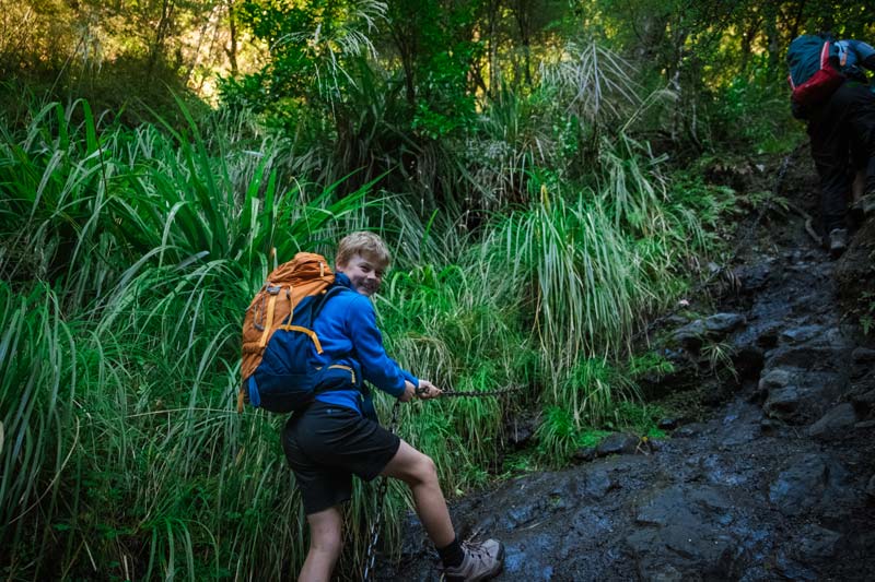
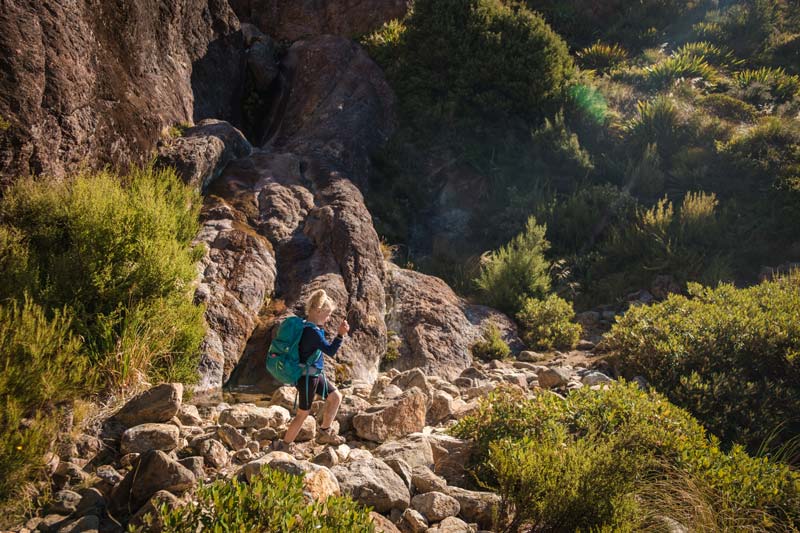
This trail starts with a pretty steep climb up the Dukes Knob and is the only big view you’ll see on this section of the track until you are close to the hut.  It’s a bushy climb and can be muddy at times.  I’d definitely recommend boots here as there are lots of tree roots to navigate and a few muddy swampy sections you can’t really avoid.

You will then head down to the river and follow this undulating trail as it sidles the river.  Lots of little ups and downs here and you’ll eventually find a bridge called Halfway bridge.  

Kids on top of Dukes Knob on the hike to Pinnacles Hut

You’ll head along otherside of the river and eventually head back up the hill towards the hut.  When you come out of the bush into a clearing you’ll have a good view over the bush expanse and you’ll be able to see the hut which is only 15 minutes or so from here.

I found the trail between Dukes Knob and the view of the hut to be quite long and there were times when I was wondering if we would ever get there.  But we did and it took us just under 3 hours which is what DOC signposted it for.


About Pinnacles Hut

Pinnacles Hut sleeps up to 19 people and you can book this online on the Department of Conservation website.  Since its only a “short walk” to the hut, it can get booked out so try and plan ahead if you can. 

There are also campsites at Pinnacles Hut that are quite private and sheltered so this could be another option if the huts are booked out or you just don’t want to hang out with snorers.

The one downside of Pinnacles Hut is that this is a one roomed hut, so the bunk beds are in the main area where you eat.  For kids, it can be hard to get to sleep earlier if everyone is awake chatting and playing cards etc.  Not a dealbreaker necessarily but it can make this a little tough.  Woolshed Creek Hut on the other hand has two separate bedrooms.

family sitting on the steps of Pinnacles Hut Mt Somers Track

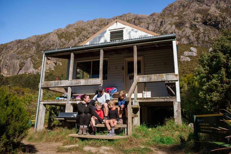
Facilities at Pinnacles Hut
  • 19 bunk beds and mattresses provided
  • Stainless steel benches for cooking
  • Fire
  • Long drop toilet outside

You will need to bring your own gas and cooking supplies as well as matches to light the fire.  You will obviously need all your overnight gear such as sleeping bags etc to stay the night.  We have a great tramping gear guide here as well as our own Backyard Travel Family recommendations for gear here

On our one day hike on the Mt Somers Track, we just stayed here for lunch then continued on.

Family walks downhill on the Mt Somers Track between Pinnacles Hut and Woolshed Creek Hut near Ashburton

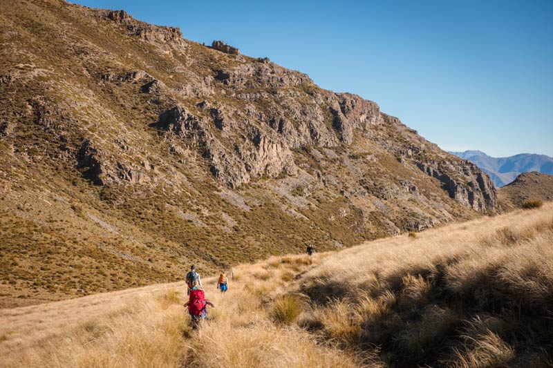
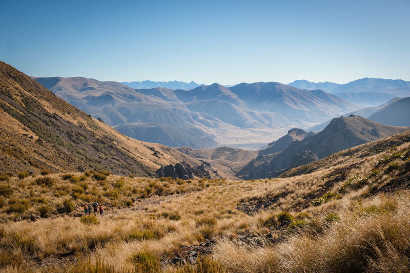
Pinnacles Hut to Woolshed Creek Hut (2 ½ to 3 ½ hours)
  • Distance according to my Garmin: 5.85km
  • Walking time for our family: 3 hours, 30 minutes compared to the signposted 2 hours 30 minutes

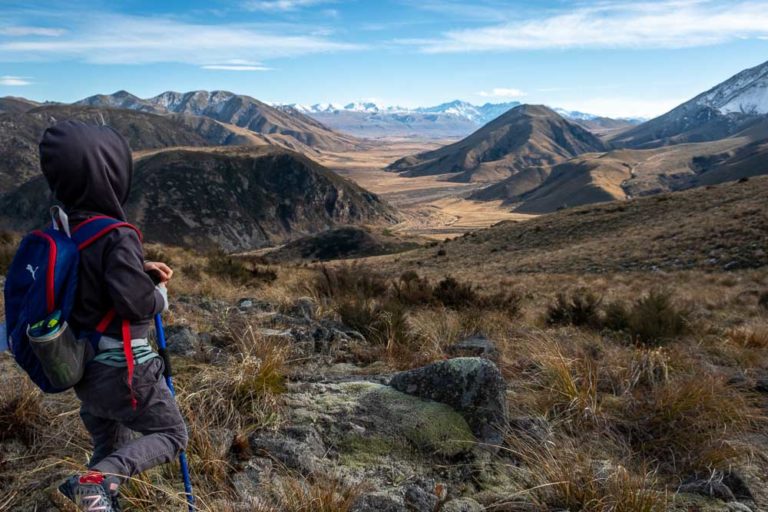
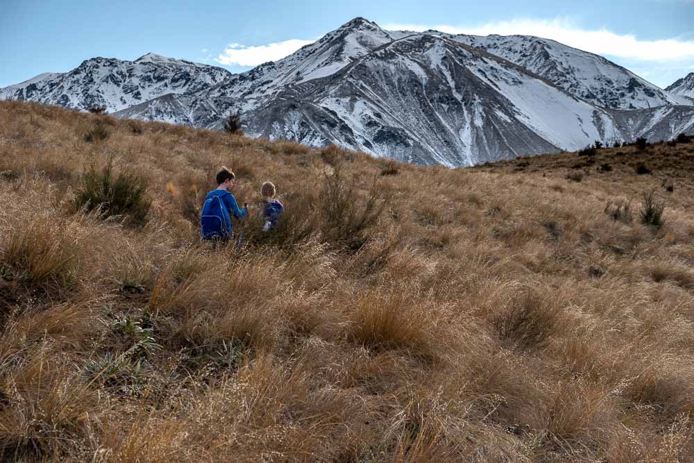
I really enjoyed this section of the hike.  Partly because I’d never done it before and was looking forward to something new.  I just loved the big open expanse of land and I bet it would look really pretty with snow on the mountains.

The hike from Pinnacles Hut starts with a steep wee climb out of the hut, but don’t worry as it only last 20 minutes or so and then the gradient tapers off to a much more gentle climb.  Think of this section as a long gradual uphill, then a long downhill.

Boy with a red backpack walks with his dad downhill on the Mt Somers hike in Mid Canterbury

It’s wide and open and you could just relax and enjoy this section, rather than having to focus too much on your foot placement like the previous section.  There’s a little climb up to Woolshed Creek Hut from the stream so when you get here, know you haven’t got too far to go.

This section said 2 hours 30 minutes on the DOC sign, but our 5 year old was feeling a little tired and was dragging her feet for this section.  In the end it took us almost 3 hours, 30 minutes.

We had an early dinner at the campsite area here around 430pm as we knew it would be getting dark around 6pm and we needed some good fuel for the final push back to the carpark.
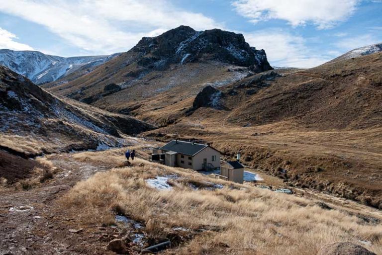
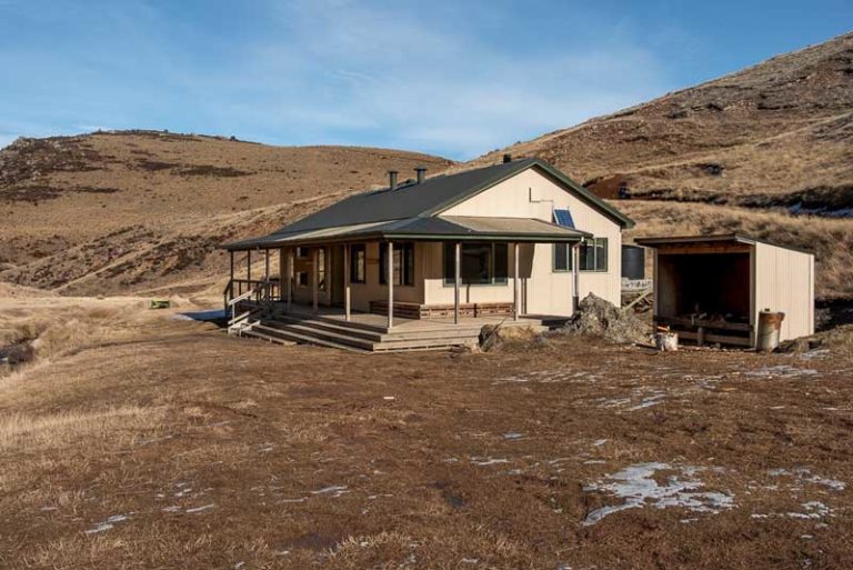
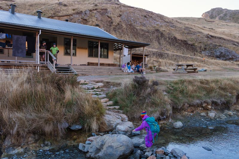
5 year old walking on the rocky terrain between Pinnacles Hut and Woolshed Creek hut on the Mt Somers Track walk
Woolshed Creek Hut

Woolshed Creek is a pretty fancy hut by backcountry hut standards.  It has double glazing and was built in 2006 to replace the older hut.  There are two bunkrooms plus a kitchen/dining area making this a family friendly hut.  I like that you can put the kids to bed before the adults if you need to and its much quieter to go to sleep.

The hut sits right beside Woolshed Creek making for plenty of creek hopping opportunities and there are also side trips to the Blue Pools and the caves.  These are both a 10-20 minute walk from the hut and can be a great activity if you’ve arrived earlier in the day.

There are some good patches for campsites here, so again if the hut is booked out, you could bring a tent and stay here too.

Woolshed Creek Hut facilities

  • 2 bedrooms with mattresses
  • A good logburner fire
  • Double glazing on the windows
  • Large stainless steel benches for cooking
  • Great verandah to sit out on
  • Long drop toilet outside

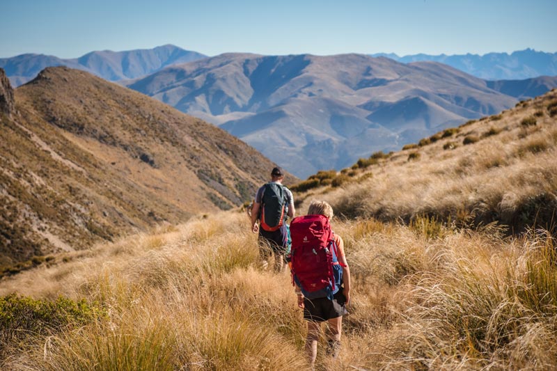
Woolshed Creek Hut to Woolshed Creek Carpark (1 hour 45 minutes)


This is the easiest section of the hike and if you’ve done the full trail, you’ll be stoked that you are getting to an almost fully downhill section (unless you go via the bus stop)

You have three options when walking from Woolshed Creek Hut back to the carpark

  1. Easiest route:  Up the 4wd track, which you follow for a while until you see a small trail arrow to turn left and join up with the main trail (1 hour, 45 minutes)
  2. Harder easy route:  Head alongside the Woolshed Creek on the same side as the hut, then head up the goat track over the hill and down again.  It’s a more technical climb and I’d avoid if its windy (about 2 hours)
  3. Advanced track: Bus Stop and Rhyolite Track which is very undulating and more technical and has soe cool rock formations. (3-4 hours)

We took the easiest route up the 4WD track which starts with a very steep uphill, but once you reach the top here, it’s all downhill from here.  You’ll stay on the 4WD style track and you’ll need to keep an eye out for a low marker to the left of the trail.  Here you will head through the long grassy tussock and meet up with the main trail again.

The boys enjoying the best half day walk for kids in Mid Canterbury or beginners overnight hike for families, Woolshed Creek Hut walk, Mt Somers Track, Mid Canterbury, New Zealand

Back on the miners track you’ll pass the old coal mine then head down through the forest trail and back to the carpark.

Once we hit the coal mine we were starting to lose light so we had to use our headtorches.  We were fully aware that we would likely run out of daylight so were well prepared for dark hiking.  We had also done this trail multiple times so there was a low risk of getting lost etc here

(do make sure you take added precautions if this may be the case)

And we made it.  After 17.1km the kids made the whole trek and while they were pretty over it by the time we got to the end, it was a feat they look back on quite fondly.

 
Mt Somers Track Loop

If you wanted to make the Mt Somers tramp a full loop, instead of heading to the Woolshed Creek carpark, you could head on the Rhyolite Track aka the Bus Stop route and then connect with the South Face and head back to Pinnacles Carpark

The track from Woolshed Creek to the Bus Stop route is quite undulating.  You’ll head over the slightly dodgy one person bridge near the blue pools and head up the hill, only to go back down again and this happens a number of times (a little demoralising when you’ve done that good uphill only to lose it again) until you reach the bus stop sign.

You’ll need to be careful as you head over the sections of boardwalk that can get a little icy and then you can head around to the left on the South Face track.  This is the one route we haven’t completed yet but I’d estimate 7-9 hours perhaps for this whole section.

5 year old Emilia at Woolshed Creek Hut Mt Somers Track

Mt Somers Summit Track (day trip)


The Mt Somers Summit track is an advanced tramping track and while the first half is pretty easy to follow, you will need to have some navigation skills when climbing up the scree to the summit of Mt Somers.  We have some good tramping experience under our belt but when the fog came in, it was pretty tricky finding our way down so do make sure you keep yourself safe.

Mt Somers summit sits 1687m above sea level making it one of the highest hikes in the Ashburton region.  

What’s a little frustrating is the DOC website says the track is 4.7km one way and takes 5 hours and the Mt Somers track brochure on the Mt Somers Track says it 5.7km and 3.5 hours one way.  On my garmin, I clocked 5 hours 39 minutes including stops over 4.69km and on the way down, it was 3 hours 30 minutes over 5.4km.

Elevation gain according to my Garmin was 1236m


What was it like climbing to the Mt Somers Summit


We hiked up this track on New Years Even (ie. summer) with my 4.5 year old, 7 year old and 9 year old.  My 4.5 year old walked the whole way up by herself but we backpacked her back down due to time.  Walking down the scree with little feet would have taken a long time and as it stands the whole day took 10 hours.

Stage 1: Bush to the bench seat (1 hour)

The first hour up to the bench seat is in the bush and can be quite muddy.  It starts pretty steeply so as your muscles warm up, your lungs are burning a little.  You’ll spend most of the time in the bush, so isn’t super exciting but a good start to the trip.

 
Stage 2:  Above the forest with views ( 2 hours )

This section was still a good climb but was much gentler. (either that or had warmed up by now, but I found it easier) You were also out in the open hiking along the top next to the trees, so we spent a lot of time wondering “are we climbing all the way up there?” 

You keep climbing until you reach the DOC signage that has your turning right up the hill, yes way up the scree or you can head straight ahead on the South Face track over to Woolshed Creek Hut or the carpark.

We fueled up here before attempting the climb that was signposted to be 2 hours.  When you look up, you wonder if it will actually take your 2 hours and it really did.  It took us a little longer with the kids and their small footing, but I’d say 2 hours would be accurate in general.


Stage 3:  The scree mountain climb  (2 hours 40 min)

This was pretty tough as there is very little path here to make quick distance of and lots of rocks to walk on.  This means you’ve got to have good concentration.  We also found this mentally a little tough as at this point the summit was covered in cloud.  We had word from a hiker walking downhill that they could see the views, but the incoming cloud was shooting in fast, so the likelihood of all that climbing was no views was imminent.

Standing at the bottom of the hill, the path will eventually head over to the right and you climb up this ridgeline all the way to the top.  

The NZ Mountain Safety Council has a good view about the Mt Somers Summit and we were careful in our decisions here with there being low visibility.  It never got bad enough that we felt unsafe, couldn’t see each other or the track, but we were very mindful of this fact and were prepared to turn around if necessary.

Once you are close to the top, you’ll see the ridgeline that heads left all the way across to the summit trig.  There’s a big flat section up at the summit, so plenty of safe space to wander around, sign the trig book at the top and have a good rest.  You’ll get great views over the Canterbury Plains, mountains and all the way out to the sea.

We stayed up here a while in hope that the cloud would clear, but to no avail.  We did get a few views on the way down though.

Note:  Mt Somers summit can be icy and snowy during the winter months especially.  Make sure you check the Mt Somers weather.  I like to use the yr.no website along with windy.com to get good coverage of the weather conditions.

Okay so that’s a lot.  If you made it to the bottom, thanks so much and I hope this has helped you decide the perfect trail on the Mt Somers Track.

Here are a few more resources that might help you in your planning

Local Amenities:  The closest grocery store is the Mt Somers store in Mt Somers Village and is closest to the Woolshed Creek carpark.  It’s a corner store so is ideal for an ice cream or a pie post trip.  There is also fuel in town.  The Staveley Store is the closest to Pinnacles car park and is a well renowned cafe.

But your best bet is Ashburton township for your full needs.  There are outdoors stores such as Macpac and Kathmandu along with restaurants and supermarkets that will have everything you need for your New Zealand hike.


More walks in the Mid Canterbury area
The boys arrive at Woolshed Creek Hut, and the last of the snow on the ground. This is a great beginners overnight hike for families, with a beautiful modern hut with bunkbeds
Woolshed Creek Hut in Winter
Jennifer

Jennifer

Founder of Backyard Travel Family

Jen is a super organiser when it comes to travel. Having travelled extensively in Europe and Africa, has lived in London and the USA and holidayed in many parts of Asia, she is not a newbie to the travel space

Jen has three young children, 10 and under and travels around New Zealand with them.

what you need to know

Travel

- Drive to the Mt Somers Track about 40 minutes from Ashburton. You'll need to look for Jig Rd for the Woolshed Creek Carpark, or Flynns Rd for the Pinnacles/Sharplin Falls carpark

The track

-- a number of tracks ranging from beginner trails to advanced tramping tracks. All except for the Sharplin Falls track are tramping trails with marker poles that is best tramped with boots. The Sharplin Falls track is very well graded and is a nice walk

Suitable for kids?

Yes, these are great family tramping options for beginners and has some harder options for families with older kids. There really is a track for everyone on the Mt Somers Track.

Facilities

- Toilets at the carparks at either end and toilets at the huts
- Many sections of the tracks are out in the open with little protection from wind and sun. Some are in the bush

What to bring

-It's an alpine area so you need to dress appropriately. The majority of these are hikes rather than short easy walks so please take good clothing, food, water and emergency supplies. Hit the icon for our tramping gear list

Food options

- Mt Somers Store is closest to the Woolshed Creek carpark and Staveley Storie is closest to Pinnacles, or else Ashburton / Methven for main supplies.

This website uses cookies to ensure you get the best experience on our website.
Is this ok? You can read our privacy policy to see how this works