Foggy Peak: An Unknown Canterbury Hike
Foggy Peak Hike
Foggy Peak has been on my list of hikes forever, however the weather has always played a fun role in thwarting my plans. But finally a window opened and there was a chance to take my two older boys (9 and 11 years old) to knock off the Foggy Peak Summit.
Now this Canterbury half day hike is type 2 fun. There’s not really a marked trail, it’s basically a couple of kilometres of uphill slog in the rocks, BUT you make it to an awesome view which certainly makes the lungburner worth it.
You can also walk onward to Castle Hill Peak but this was enough for us for today. If you are looking for an easier Canterbury hike, you could also try the Trig M Track, which is just across the road (you can see the trail from this hike) or Castle Hill which is an easy Canterbury walk)
Foggy Peak Hike: The quick details
- Where is Foggy Peak: Torlesse Tussocklands Park, before Lake Lyndon on the way to Arthurs Pass
- Foggy Peak Hike length: About 2.2km one way
- Hike time for Foggy Peak: 2-2.5 hours up hill, 1 hour, 20 minutes downhill
- Foggy Peak Elevation: 1741m above sea level

Article Table of Contents


What is it like to hike to Foggy Peak
Foggy Peak has some of the most beautiful views, but I’m not going to lie, it’s quite a slog. It’s about 2.2km uphill and the hike is all climb. Those few nice metres between orange marker poles, that was your warmup and then it’s time to get your climb on.
If you take a look at the big hill from the bottom you’ll see two humps (that’s the technical term) You are heading to the top of the furthest mountain and the closer one is what I’m going to call the false summit.

The details of the Foggy Peak hike: I broke this into three sections
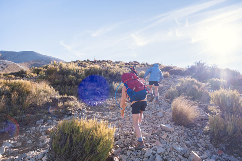
Section 1: The start, the small stones to the tussock
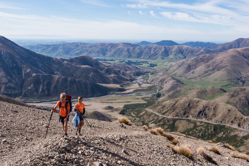
The track is quite hard to follow for the first section. There are some marker poles however they kind of disappear and there are many paths that look like trails. I imagine most of these are made when people are scooting down the scree and just taking that path of the least resistance.
I could see a route on my Garmin and we often seemed further to the right of the trail, so in general, I’d say stay to the left and don’t head too far right or you’ll just cover a whole lot of extra ground.
You should be able to find some rock cairns on the way up that are quite helpful in lieu of marker poles.
This section to the bottom of the tussock took us about 30 minutes, but I swear I checked my watch at 7 minutes. It’s not too bad but your muscles haven’t really warmed up yet so it feels harder than it is.
Section 2: The big scree to the false summit
There are much bigger pieces of rocky scree here and this section is the steepest part of the climb and more awkward. It took us 1 hour and 20 minutes from the scree to the false summit. This included a few decent stops as I was shooting some brand photos along the way.
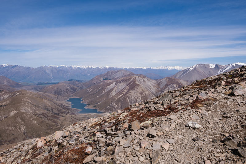
You start to get some great views from this point. If you look across the main road you will see Lake Lyndon and the outlines of the Trig M Track. This is a great alternate trail that has lovely views too and is not nearly as difficult. It’s a great hike for beginner trampers, whereas this one is not.
Section 3: The false summit to the real summit
The false summit is a great place for a break if you need it as it’s the only piece of flat ground you will find on the whole Foggy Peak track. There’s a big rock cairn and a line of rocks that my kids called the red carpet, leading to the final push to the top.
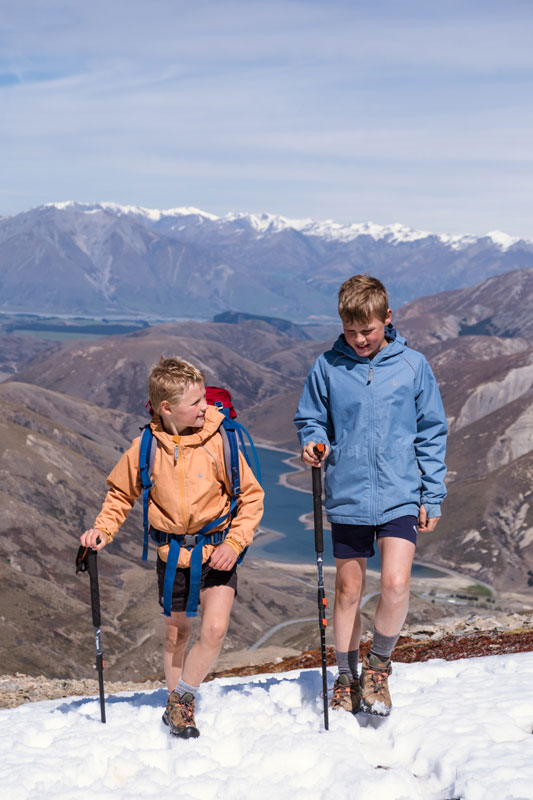
From the false summit to the real summit it took us around 30-40 minutes. We found snow along the way, some puddles of it so there wasn’t too much and of course, a wee snowball fight was inevitable.
I didn’t find this as difficult as any of the other sections, however there are a lot of endorphins about when you know you are almost there.
The whole walk took us 2.5 hours but I think if we didn’t muck around so much it would have only taken us 2 hours.
What I liked about the Foggy Peak Hike
- Great views
- Walking up to the ridgeline near the summit was fab
- You can see Lake Lyndon and Trig M and all towards Castle Hill Peak, that you’d never see from the road. The Torlesse Range is pretty cool.
- There’s a big summit area which is flat, ideal for lunch but it is exposed and can be very windy up there.

How to get to Foggy Peak
You’ll find Foggy Peak in the Canterbury region in the South Island of New Zealand. If you’re Christchurch based, it’s a great day trip.
I always feel like Foggy Peak and Lake Lyndon is the entrance to Arthurs Pass, but its actually in the Porters Pass area. Arthurs Pass National Park is much further down the road, but it’s the beginning of the mountains in this direction.
It’s just over an hour from Christchurch Airport and the path and the carpark isn’t actually marked so you need to know what you are looking for.
Foggy Peak Carpark: You can park at what google maps has labelled Porters Pass Viewpoint which is a layby at the top of the hill on the right hand side coming from Christchurch. If you make it to Lake Lyndon, you’ve gone too far.
You will find a couple of marker poles near the bottom and then you really have to follow your nose.

Foggy Peak Weather
Given the alpine area, the weather in Arthurs Pass region can be very volatile and changes quickly. There is likely to be snow in the winter (June, July, August) and some in Spring too. The Foggy Peak walk is very exposed so please make sure you are dressed appropriately and have the necessary skills (advanced tramping skills and avalanche training) if you are likely to trek in snow season
I search for “YR Foggy Peak” which gives me a good indication of the conditions on this hike.
You might be interested in some more Canterbury walks. Check out these articles
- The Best Canterbury Hikes
- Trig M Track (same region) 2-3 hours
- Castle Hill: great for exploring
- Rakaia Gorge Walkway: 3 hours return
- Peak Hill: Amazing lake views, 3.5-4.5 hours return
- Mt Somers Track: multiple short walks for families or 2-3 day walk.


Jennifer
Founder of Backyard Travel Family
Jen is a super organiser when it comes to travel. Having travelled extensively in Europe and Africa, has lived in London and the USA and holidayed in many parts of Asia, she is not a newbie to the travel space
Jen has three young children, 11 and under and travels around New Zealand with them.
what you need to know
Travel
- It's just over an hour from Christchurch Airport to the Foggy Peak Track
The track
- very exposed trail
- mostly scree the whole way, some quite deep for easy bounding down
- need route finding skills, only a few marker poles at the beginning
- 2.2km ish one way to the summit
Suitable for kids?
Better for older kids who have good tramping skills. Not a beginners hike (try Trig M as a good alternative
Facilities
- No toilets at the beginning of this track, but head down to Lake Lyndon for these facilities
What to bring
- Food for a good half day
- Rainjacket and windproof jacket
- Sunhat or beanie as appropriate
- decent walking shoes, but I prefer boots on this trail.
Food options
- the dairy in Darfield does extremely large scooped ice cream and is a good post hike reward
- Springfield pies are super popular
- Closest supermarket is the 4 Square in Darfield


