Tama Lakes Walk: An alternative to the Tongariro Alpine Crossing
Tama Lakes Walk: 17.6km return hike to Volcanic beauty
The Tama Lakes walk is a great alternative to the Tongariro Crossing. Not only is the Tongariro Alpine Crossing super busy, but you also have to organise transport, whereas this is an out and back loop track, ending back at your car.
There are still beautiful volcanic views and amazing lakes, but the elevation is much less. It is still high up in terms of altitude so the weather can be extremely variable. So if the Tongariro Alpine Crossing isn’t quite for you, you might love this National Park walk.
The Tama Lakes track is located in Whakapapa Village in National Park in New Zealand’s North Island. It’s close to the Ruapehu and Taupo regions so you’ll find plenty to do when travelling around the region.
Quick details
- Tama Lakes from Whakapapa Village: Took us 3 hours, 15 minutes (signposted 3 hours) and about 7 hours round trip with a big lunch break and a big play at the waterfall.
- Tama Lakes distance: 17.6km return
- Elevation gain: about 500m of elevation gain
- Lower Tama Lakes: 1240m above sea level
- Upper Tama Lakes: 1440m above sea level
Article Table of Contents

The Track Terrain
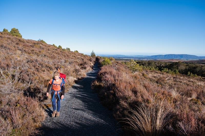
The track was very well maintained and easy to walk on in shoes. The only part you may have considered hiking boots for (which we were wearing) is the rocky scree section between Lower Tama Lakes and the Upper Lakes. But the hill doesn’t take too long here. I’d say its Great Walk standard here.
It’s very easy to navigate and you can’t get lost. So the trail itself was very easy, just quite long.

What its like to walk to Tama Lakes Tongariro
The Tama Lakes walk was far easier than I was expecting. While it is a long way to walk at 17.6km return, there is only around 300m of elevation difference between the start of the trail and the terminus at the Upper Tama Lakes.
The Tama Lakes Track also incorporates the Taranaki Falls trail so you can make this a bit of a loop track to mix it up. We started on the Upper Taranaki Falls trail, headed out to Upper Tama Lakes and headed back past Taranaki Falls and out the lower falls track. Then we just headed back up the road to finish. So let’s dive into it and show you a bit more what it was really like.
The Upper Taranaki Falls track starts at a little carpark in Whakapapa Visit. The majority of this track is extremely exposed so while the track itself isn’t difficult, the weather conditions will need to be favourable on this walk.
We purposely drove all the way to National Park for this particular walk and the one fine day on the weather forecast for a week and I have to say, we nailed it and it was absolutely worth it. We visited at the beginning of October, so mid Spring and the forecast was for 2-8C that day (and increase from the original forecast of 0-4C)
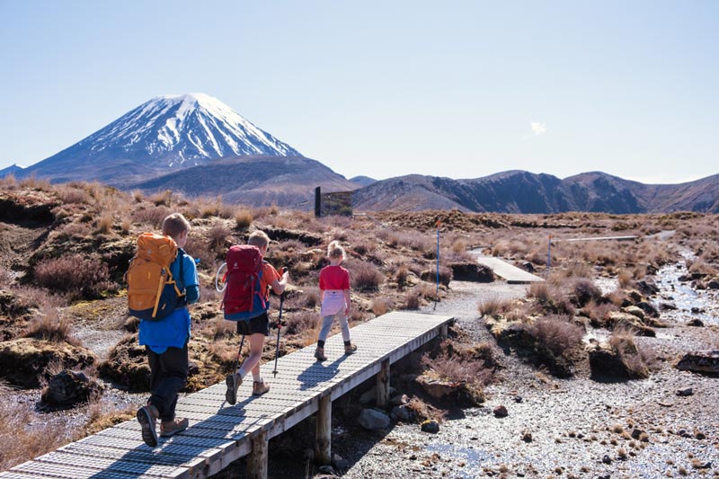
The first part of the Tama Lakes hike is incredibly easy, following the boardwalks and gravel path. It starts in a little bit of bush, but that doesn’t last for very long. You will head towards Mt Ngauruhoe (aka Mt Doom from the Lord of the Rings) There’s some undulating tussock country but the walk itself from here feels pretty flat.

It took us around an hour to reach the crossroads where you turn left to head down to Taranaki Falls (saving that bit for later) and right to head up to the Tama Lakes. There is a good little climb here and we stopped for a morning tea break on the hill before continuing.
This is probably the only real climb which isn’t really too difficult before the final climb to the Upper Lakes. I was surprised how flat it was and any minor undulations were gradual. There’s lots of boardwalks and you can really put a pace on during these kilometres to make some gain. 8.8km is a decent distance, but the time seems to pass without us knowing it.
There is a toilet stop at the turn off to the Tama Lakes. It’s quite camouflaged which I appreciate. The other option is to continue Waihohonu hut which is part of the Tongariro Northern Circuit Track, a New Zealand Great Walk

Then it’s actually not too far before you reach the Lower Tama Lakes. Hiking the Tama Lakes Track with kids, it took us just under 2.5 hours to reach the Lower Lakes which were quite beautiful. There were some information panels about the volcanic area and the lakes. We took a couple of photos here, but the real viewpoints were on the way up.
This is where the real climbing will begin, but don’t worry, it doesn’t actually take too long. It’s not too difficult for navigation as there are marker poles along the way and then you follow the ridgeline to the top.
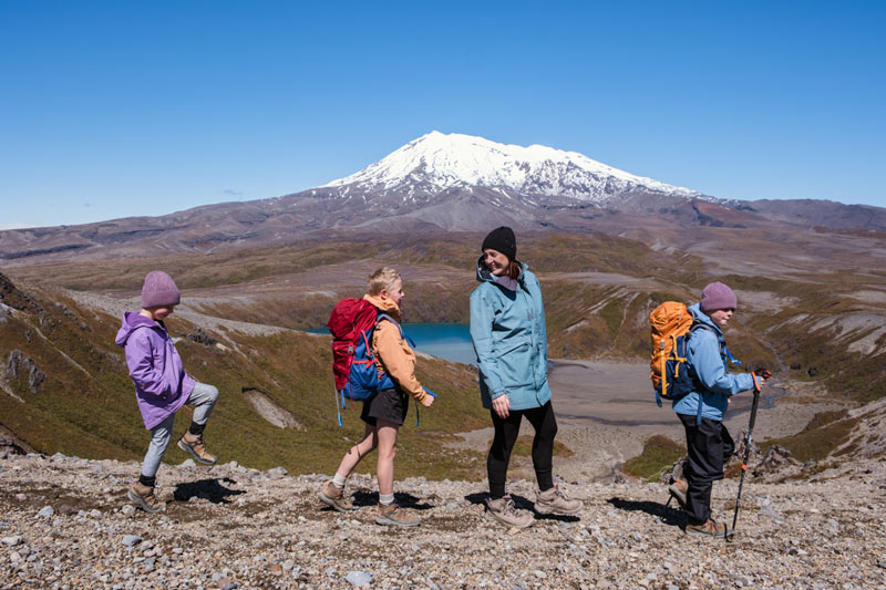
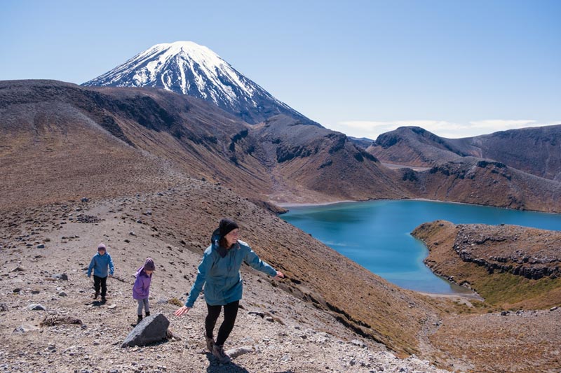
With some photo breaks along the way, it only took us 30-40 minutes to meander to the top and it is totally worth it. Unless its full covered in cloud and you know there will be no views, you don’t want to skip the final push to Upper Tama Lakes.
The hill is quite steep and there is scree (lots of loose stones on a mountain) on a good section of it but just work your way up there slowly. If you follow us on Instagram, you’ll know that I love a good ridgeline and there’s honestly nothing better than walking along the tops of the mountain.
With all the stops along the way the walk to Upper Tama Lakes took us 3 hours and 15 minutes which I think was pretty good for our crew. My 6 year old hiked the whole 17.6km so did a great job.

Upper Tama Lakes Summit
Even though we ended up walking in shorts and tshirt during the main section of the walk as it did warm up nicely, the summit was cold. The kids had jackets and woolly hats on at the top, along with thermal tops and sweatshirts.
Definitely do not underestimate the change of weather in alpine areas, even on what seems to be a warm day or perfect conditions. But if you prepare well, this Tongariro track will make for an epic day.
Note: You cannot swim at the Tama Lakes (to protect it) but you could dip your feet at Taranaki Falls on the way back. It’s pretty cold though haha.

Taranaki Falls Walk
One reason I like to do Taranaki Falls near the end of the trek is that it gives you something to look forward to. We walked from Upper Tama Lakes to Taranaki Falls with just a toilet break and this took us around 1 hour and 50 minutes.
We stopped at Taranaki Falls for afternoon tea, took off our shoes and cooled them in rocks (its freezing let me tell you) and it was a final 50 minute walk back to the car.
Taranaki Falls is a cool spot. Despite being only 20m high, there is a lot of water flowing here which makes it quite impressive. If you’re game, you can walk behind the waterfall for a unique view.
The final 50 minute, 3km walk back to the car is mostly in the bush. This is the other reason I recommend doing it last as you are often in a hot part of the day and its a great place to escape the burning sun. The trail is lovely and there are some undulations here, along with some incline on the way back to the road.
As long as you don’t expect it to be a full downhill walk back to the car, you’ll be fine. It’s not difficult but there are a few rises here.
Taranaki Falls and Tama Lakes are both great hikes and I think you would be happy doing either of them to explore this unique landscape
Read more about this Taranaki Falls hike here

How to get to the Tama Lakes Walk Tongariro National Park
The trailhead of this walk is pretty easy to find and I recommend doing the Upper part of the Taranaki Falls track first, I think this direction is easier. You will park at end of Ngauruhoe Crescent right near the Skotel Alpine Resort. There is a small DOC carpark here.
If you return via the lower track aka a loop of Taranaki Falls, you will end up just a bit further down the road and can walk back up to the carpark. It’s only a few hundred metres and will only take a few minutes.
Nearby you will also find the Tongariro National Park Visitor Centre who will have a good idea of the weather conditions if you are concerned


Tama Lakes Weather
The alpine territory here is very volatile so the weather conditions can change and it can go from sunny and warm to windy, cold and hypothermic at any time of the year. So whatever you do, go prepared.
Whakapapa Village is 1140m above sea level (even Mt Cook Village in the South Island is only 750m) and that’s before any climbing is done. It doesn’t feel that high and most of the region is elevation. In fact, just feels like a flattish area but head my warning, dress appropriately.
Niwa has some great Tongariro weather forecasts where you can see the visibility, wind predictions, temperatures and more. There will also be a recommendation about whether the walks such be attempted, including Tama Lakes Walk and the Tongariro Crossing.
Note: There is an avalanche danger between the Lower Tama Lakes and Upper Tama Lakes during winter and anytime when there is snowfall.

What to pack for the Tama Lakes Hike
We travelled in early October in Spring. The weather forecast was for sunny clear skis, low wind and a high of 4 degrees and low of 0
This is what we took on our hike
- Windproof Clothing: Waterproof Jacket and Rain pants (no rain forecast but its a light extra layer for warmth)
- Thermal long sleeve top
- Thermal long pants
- Tshirt and shorts
- Sweatshirt
- Warm hat
- Should have had gloves (but used socks instead, just needed for the top of Upper Tama Lakes)
- Plenty of water
- Lunch, morning tea and afternoon tea
- Hiking Pack and Raincover
- Hiking Poles, although didn’t really need them (maybe just between Upper and Lower Tama Lakes)
- Warm socks
- Hiking boots (could have got away with sturdy shoes, but good if you have dodgy ankles on the scree)
- PLB
- Emergency Blankets
- First Aid
Even though the day ended out super warm and around 8C, which is the direct sunlight felt like 15C, we did use all of our warm gear up at the Upper Tama Lakes summit. Even the hat and “gloves” as it was windy and cold up there.
So with all of that in tow, I think you’re ready for an epic tramping trip
If you’re keen to know what tramping gear we recommend or would like to know more about what to pack, you can see our tramping guide here


Jennifer
Founder of Backyard Travel Family
Jen is a super organiser when it comes to travel. Having travelled extensively in Europe and Africa, has lived in London and the USA and holidayed in many parts of Asia, she is not a newbie to the travel space
Jen has three young children, 11 and under and travels around New Zealand with them.
what you need to know
Travel
- 15 minute drive from National Park, 35 minutes from Turangi, 40 minutes from Ohakune and 90 minutes from Taupo
- Park at the DOC signage at the end of Ngauruhoe Terrace
The track
-very well maintained track
- easy to navigate
- allow 5-7 hours return with stops
Suitable for kids?
It's a long trail at 17.6km return, so if the kids could walk for that long and the weather conditions are good, then I think its a great walk.
Facilities
- Toilets on the trail near the turnoff to Taranaki Falls and the Tama Lakes track as well as the turnoff to Lower Tama Lakes
- very exposed so would be horrific in high winds
What to bring
- Waterproof and windproof clothing
- The rest of the tramping checklist is listed above
Food options
- 4 Square Supermarket in National Park, 15 minutes away
- Closest Restaurant and Bar at Skotel Alpine Resort
- Some takeways and restaurants in National Park or head to Okakune or Turangi about 40 mins away.


